Ohiopyle State Park, PA

We arrived before check-in time on Sunday, August 2, at Ohiopyle State Park’s Kentuck Campground, so we got permission to head to the dump/water stations and empty/fill while we waited.

In the past, Ohiopyle—the village in the middle of the state park—along the Youghioigheny River (pronounced yak-a-GAIN-ee and called The Yack for short) and the Great Allegheny Passage (GAP) Rail-Trail, has been a favorite among our stops. We had never until this trip, however, been there in the “high” (read “swimming”) season. You can check out two of our prior visits, one without bicycles during 2015 here; and details of riding the Ohiopyle segment of the entire GAP on a wonderful ride during 2018 here.

The “Yack”

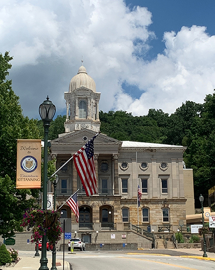
For the curious among you, here’s a short shot of history about Ohiopyle: 

Once called Falls City, this town’s economy has always been driven y the power of water. The name Ohiopyle is derived from the Native American word, “ohiopehhla,” which means white, frothy water. Once considered for the route of the Chesapeake & Ohio Canal, the Youghiogheny River here was clearly not suitable for navigation by barge.

The rural economy grew when the B&O RR came through in 1871 and later the Western Maryland, whose corridor is now the GAP trail. Ohiopyle thrived as a popular summer resort until the early 1900s, with thousands coming by rail from Cumberland and Pittsburgh.

Early industries depended on the force of water to drive machinery—now tourism based on whitewater rafting and other outdoor recreation drives the economy. 

The entire Ohiopyle State Park is quite vast and includes multitudes of hiking trails, including steep grades, gorges, and cliff faces, all over the place. Not only hiking but also horse trails, snowmobile trails, rock climbing opportunities, special natural areas, and birdwatching and photography sites are included.

Ohiopyle State Park

Along with the venerable GAP (starting in Pittsburgh and going all the way to Cumberland, MD) two of Frank Lloyd Wright’s famous constructions are nearby: Kentuck Knob and Fallingwater. Closings were strange for the two properties in the Time of Plague, but in the past, the tours were both worth the money. This time, John and Mary were able to tour Kentuck Knob’s outdoor sculpture gardens, but not the house’s interior.

But I get ahead of myself.

En route, Jack and I noted a slight issue with the wireless brake connection from the car to the trailer. Well, it was more than a “slight” issue—there was no connection between the trailer’s brakes and the car’s. Normally the controller is able to proportionally brake the trailer in tandem with the car’s braking pressure/strength and help ease the load on the car brakes.

So we took it slowly and carefully until we could figure out what the issue was (having fiddled and plugged/unplugged everything we could think of when we stopped to try to find the trouble ourselves).

As we were parked at the potable water station (one of the bath houses) John and Mary pulled up, also too early to set up, so we all stayed near the entry gate per instructions, and chatted. In addition to John and Mary, their dog Riley was a welcome sight and he was happy to receive our scratches and pats—possibly a bit over-enthusiastically on our part, since we’d been dogless for so long. 

J & M had the farthest to travel, so we’d earlier promised them a hot dinner on arrival night—a chicken pot pie cooked in the Dutch oven. After basic set-up, I got to work on what I’d started the day prior (chopping and sautéing veggies) so we would be able to eat before 9pm.

The two sites we reserved (electric only—225 & 226) were off to themselves, quite near two bath houses—the one at which we filled up our water, plus one serving the Ivy and Juniper loops.

Having arrived on a Sunday, we were hopeful that most campers would have left for the week. But an enormous group (from their dress it was obvious they were a religious group) easily took over both bath houses when it was shower time. Not a one of them of any age wore masks, and it was impossible to use the facilities when the gang was all there. Happily, they had an outdoor hymn-singing Sunday night, and most were gone by noon on Monday.

After our delicious dinner (even if I do say so myself) we enjoyed an International Space Station pass over our heads Sunday night. It was a great day (except for having to share space with such a large no-mask contingent).

Monday, August 3: There must be a Cooper’s hawk nest or roost near our sites. I heard one of them moving through the woods overhead, and then watched as it and another gained lots of height to soar off into the distance. Monday mornings have been our health-check times, but we were unable to get the pulse oximeter to work—it just would not recognize that our fingers were actually in place. But we took our temps anyway, which were both normal for us.

Later, we heard from a nurse that the sensors get filmed over, and need a wipe with rubbing alcohol now and then—we did that the following Monday, and it worked again (yay).

It was a morning for everyone to manage chores: Jack worked on the electrics for the brake controller; John sought 2PM tickets to the sculpture gardens at Kentuck Knob; Mary had a friend’s logo project to work on; and I got the bikes off the rack, pumped tires, and lubricated chains. After that, I took a short tootle through all the loops of the campground, putting about 3 miles on the odometer.

It was another beautiful day, with morning temps around 75. Jack finally re-paired (repaired) the wireless brake controller. He could tell there was a connection, but we waited until departure to calibrate it again, once the trailer was re-hitched.

Jack and I drove the bikes to town to ride the Ohiopyle to Confluence leg of the GAP (while J & M went to Kentuck Knob) and we found the village to be absolutely mobbed with “waterbabies,” as I’ve come to call those people who disregard The Time of Plague in favor of pretending this summer is just like all others before, and they can swim, raft, eat ice cream, shop, and party like it’s 2019. The photo below of “waterbabies” doesn’t depict the gobbets of people along the shores above and below the bridge from which the shot was taken (nor the # of people I had to avoid on the bridge to take the shot).

It was an extremely rare sight to catch a mask on anyone’s face. Piles of people were picnicking and visiting along the shores of the river, standing in lines to get into a pub or to buy a summer treat; swimming in the river, or on a float trip or raft trip with 12 other people; and gathering in large clusters, without masks or social distancing, everywhere we looked.

We rolled our bikes through these crowds (wearing our masks) to get to the trail, and hared it out of the “stupid zone” along the more distant reaches of the GAP. Once we were free of the mob, it was a fantastic ride. 

Unfortunately, I bumped the “off” button on the Cyclemeter app and missed calculating/recording the entire first 10.5 miles of our 21 mile ride. The good (interesting) part of this omission/accident is that the outbound half was upriver (ascending) and the return ride was downhill (descending). So I managed the highest average MPH I’ve ever ridden for the final 10.5 downhill miles @ 15MPH. Jack, who got both directions, logged a nearly 14MPH average, which is still a great spin speed. So I’ve adjusted my record to reflect his, as we rode the entirety together.

Bike Stats: 21 miles; 1:30 ride time; 15 minutes stopped time; 13.96 MPH average speed.

We cooked pizza on the grill’s pizza stone for dinner, shared the meal as usual with appropriate distancing with J&M (&R), and it was too cloudy to see any stars by the time we turned in.

On Tuesday, August 4 the rains came and went all day, and the humidity was brutal. Everything felt wet, even inside. We had leftover pizza for lunch, and enjoyed a visit from fellow Altoistes, Corde and Ray, who live about an hour’s drive away. We had a thoroughly enjoyable afternoon of chatting about this and that, even though several downpours chased us all scuttling like crabs (with our chairs) under the awning. It was a little “tight” under there for four, but we managed to stay distanced from one another and not get terribly wet during the rain.

The more it rained, the chillier it got, and by the next morning (our departure day) the low was 60 degrees (!!).

Raccoon Creek State Park-PA

Sunday July 26: After a short drive from Crooked Creek Lake (but a stressful experience trying to get through Pittsburgh, even on a Sunday) we arrived at Raccoon Creek State Park, 23-ish miles west of Pittsburgh (mailing address is Hookstown, PA). The state park itself is quite large, with many hiking and mountain-biking trails, a wildflower reserve, a horse-rider’s camp (and equestrian trails) etc. The actual campground, however, is moderately-sized and fairly closely packed among its 6 loops, although it is quite likable. While our site had lots of distance between us and the next site at our awning side, the separation from us and the next site (E9) to our utility side was close to nil. Happily, it was a day or so before anyone moved into E9.

The facilities are fine and clean with two (count ‘em: TWO) dishwashing sinks, each one just outside of each of the men’s and women’s bathhouse sections. Our site was E-8, electric only (but we traveled with a tank full of the tasty water from Crooked Creek Lake—and were glad we did because the Raccoon Creek water had a faint smell of sulphur, although it tasted fine).

When we arrived, however, our fire pit was filled with melted plastic trash and broken bottles. The site was pretty much trashed, with broken tent stakes and bits of detritus everywhere. I collected much of it for proper disposal, and Jack reported the maintenance oversight to the less-than-concerned gatekeeper. She lamented that the maintenance folks stopped work on Sunday at 3:30—but promised she’d send a ranger along the next day to assess and report the mess.

There is also the fact of the flightpath to Pittsburgh’s airport to consider with respect to Raccoon Creek. It was not any sort of a problem for us with the noise-cancelling AC, but it might be a factor Post-Covid: flights were relatively few during our stay, but most flight numbers in the US are down due to the pandemic. So if you consider a stay here, that might be more of a factor in the future.

We enjoyed Loren Yoder’s ground beef (bought in Floyd and brought frozen) grilled as chopped steaks with salad and mashed potatoes for our arrival dinner—easy and delish.

On Monday, July 27, a doe and fawn greeted our stroll down the hill to the bathhouse.

Had some fun with the shadow thrown by one of the bike’s handlebars (still on the front rack) on the BFW before it got incredibly hot.

The entire day proved to be VERY HOT (87 degrees at 11a; 89 in the shade by noon; still 90 at 5p) so we enjoyed a leisurely day. It being Monday, we took our pulse oximeter readings and temperatures and all were normal for us (although the PO was very fiddly—it was difficult to convince there was a finger inserted, so it kept turning off before reading the levels. Changed/charged the batteries, fiddled and fussed to get anything out of it—very frustrating).

I worked up two blog posts to catch up my loyal followers on our adventures, and we drove to the Allegheny Regional Library (near Imperial) for wifi, mail dumps and replies, and a couple of blog uploads. During my library time, Jack braved a Price Cutter store where everything was a jumble. It was more than just an unfamiliar layout—the aisles were chaotic like a big box store with categories of items stacked together every which-way.

The predicted cooling/cleansing rains came just as we were getting ready to eat a “Rancher’s Pie” (shepherd’s pie with bison instead of lamb). Intending to have a Solo Stove fire for ambience, and with the fire laid but not lit, a neighbor stopped by and offered us his leftover firewood, which we happily accepted, readying to go fetch it—but he said he’d drop it off the next morning as he was leaving (which he did, circa 8a).

After speaking to him, we scurried to secure everything for the rains that came in buckets, and ate inside, then turned in early.

We got back on our bikes the next day, Tuesday, July 28. Moderately close to Raccoon Creek SP is the famous Montour Rail-Trail, billed as “The Nation’s Longest Suburban Rail-Trail” at 63 miles long (or 61, depending on your source).

Here’s an excerpt of what the PA Rail-Trails Conservancy Guidebook has to say about the Montour:

[The trail] follows most of the former Montour Railroad’s main line west and south of Pittsburgh. This short line was incorporated during the late 19th century and, despite its small size, became very profitable thanks to the many coal mines once located along its main line. It also benefited from having interchanges with most of the region’s notable railroads. Once it became a subsidiary of other RRs, and when the coal mines died, the Montour line was forced to shut down during the mid-1980s. The corridor today forms a semi-circle around Pittsburgh and features a selection of bridges, trestles, viaducts, and tunnels framed by colorful Western PA landscapes, suburban as well as rural.

At the top of the map photo you’ll see a big circled 0, which is the start, at a township called “Moon” near Coraopolis (PA 51/Coraopolis Rd).

The readerboard at the start of the trail gives a bit more history, in case you’re interested. If not, skip the section below.

In 1875, Pittsburgh’s William McCreery considered (and subsequently, partially built) a new railroad line starting on Pittsburgh’s south side and traveling along the southwest bank of the Ohio River, crossing at Beaver and following the rivers to Youngstown, OH. At Montour Junction, passengers and coal could transfer to the PA & Lake Erie RR. 

In March of 1936 heavy rain and snow melt flooded the Ohio River. Montour Junction and Coraopoilis Streets were deep under flood waters, and the damage was extensive in Coroapolis. 

While the Harmonite family had played a large role in building and financing the P & LE RR, they sold their interest to the Vanderbilts. In 1946 the P & LE RR acquired 50% of the Montour RR and in 1976, it became sole owner.

Consolidated Glass of Coraopolis, located just downstream from Moon Twnsp, was the nation’s primary producer of utility and art glass for many years. Railroads used glass-globed lanterns for signaling between the engineer and the conductor. Coraopolis glass is still avidly collected.

Not far from the Northern terminus is a burgh called Imperial (Enlow Rd., where the “Airport Connector” trail begins) with a nice parking area. This trailhead is not far in actual distance from Raccoon Creek SP, but it’s almost impossible to get there from here, making it a twisty, winding 30-minute drive to the trailhead. It is about 8 miles to the northern terminus at Moon/Coraopolis, so our first day’s ride was a fairly easy (though humid) pedal of just under 16 miles.

The RR and trail corridor are named Montour in honor of a noted Native American scout, interpreter, and negotiator who worked for George Washington and Conrad Weiser. A variety of Native names have been attributed to him, including Oughsara, but his “Americanized” name was Andrew Montour. In 1769 and in return for his services to Washington and the colonial government, Andrew Montour was granted 335 acres of the land surrounding the creek that came to be known as Montour Run. The land grant was called “Oughsarago” to honor his native roots.

A family named Slover lived near the waterway before it was granted to Montour. In 1761, Tom Slover was 8 years old when he was sent out to capture a snapping turtle from the run for the family’s dinner. He was captured by warriors of the Miami tribe, taken to the area that became Ohio, and traded to the Shawnee. Twelve years later, he was recognized by a family member when he accompanied Shawnee traders to Ft. Pitt. He escaped, and stayed there serving in the militia—yet was recaptured near Montour Run by Wyandotts. The Native penalty for escaped captives was death by gauntlet. Stripped naked and painted black in readiness for execution, Tom escaped once again, and was able to make his way to Ft. McIntosh and warn them of an impending attack. 

Jack had found some frozen shrimp at the Chaos Grocery, and he grilled them for our dinner, and we plotted our next day’s ride.

In the wee hours of Wednesday, July 29, we awoke to the clatter of aluminum cans and the unmistakable “sploosh” of a carbonated beverage opening in the night.

A raccoon had found the small cans of tonic we’d left beside the ice chest under the awning and it appeared to find them interesting—that is, until he bit into the side of one of the cans and the jostled beverage spurted out of the can at it. All we found were the tossed-about cans (one with a tooth hole—left—and one with bite marks) and a trail of tonic water and footprints across our outdoor rug.

For our Montour ride #2, we parked again at Enlow and headed southwest (the opposite direction) to our destination: Southview. With a dusty, sunny parking area beside two operational RR tracks, Southview lies a little beyond where the Panhandle Trail—headed west into WVA—intersects the Montour (see map image above).

Between mile 17 and 18 is the McDonald Trestle, a very long, impressive span under which the Panhandle Trail runs.

At the Southview parking lot (our turn-around point) we noticed some nice ironweed growing in a low-lying (presumably wet) section of ground just off the picnic table where we had a snack before turning around and heading back to the car parked at Enlow.

There was some construction on highways above the trail, and some on the trail itself, and a long, sunny, hot section through what felt like a reclaimed industrial site. That section was a significant grade upwards on the return during the heat of the day. But we made it just fine and had some good pedal-turn-rates to brag about.

Bike Stats: 27.5 miles; 2:10 ride time; 33 minutes stopped time; 12.68 MPH average speed.

After a nice shower upon our return, we ate rancher’s pie leavovers. 

Thursday July 30—Happy Birthday, John!—was another rest day for us, so we headed into Imperial again, where we’d seen a laundromat. We drove through the wildflower reserve (part of the park but up the road a bit) and found it to be all hiking trails—no driving except into the parking lot—and the Visitor Center was closed.

A quartet of rowdy guys with a Jeep that played nothing but very loud rap music moved in next door (the utility side with no separation, naturally). Evidently, they (or one of them) lived nearby as they spent most of their time gone elsewhere except for one notably loud party night.

While we were sorting through some of our frozen dinner choices, the door on the freezer section of the ‘fridge broke off. Jack was able to jury-rig it to stay up, but we’ll have to be more focused on defrosting on the road in future, to prevent a repeat (once we return home and get the door replaced).

Montour #3 was Friday July 31. We parked at the Southview trailhead, and rode to a little burgh called Library. From there to the southern terminus, the Montour is broken up with some significant sections of urban riding. Ultimately it reaches Clairton, and the connector paths to the Great Allegheny Passage.

Southview sights:

Jack discovered some difficulty with his rear derailleur—in essence, he had just 3 of his normal 22 gears. Thank goodness the trail was relatively flat and beautifully shady on this day. 

As we passed a large town called Henderson, we caught the aroma of ‘burgers and fries, and saw a sign offering burgers and doughnuts (?). Jack threatened to leave the trail for that one, but his gearing problems stayed his handlebars. The story of the Henderson Mine is quite typical of the many once-thriving coal mining operations along the trail.

The Henderson Mine Story: The Henderson Coal Co. opened its mine upon completion of the Montour RR’s Mifflin Extension in 1914. The coal seam was about 230 ft. Below ground and was serviced by two vertical shafts. One brought men and supplies into the mine, while the other brought loaded mine cars from the mine to the tipple building. Mules were used underground to pull the mine cars to the tipple.

The most tragic occurrence at the mine took place on March 13, 1917, when a methane gas explosion killed 14 miners.

Miners’ homes and boarding houses filled the three hillsides behind the mine. The company store and other nearby businesses served the needs of the entire Hendersonville Community.

Henderson Coal Co. operated the mine until 1942, when it was sold to the Pittsburgh Coal Company. The mine was closed in the late 1940s.

Despite the death of the coal industry, Henderson appeared to be a thriving ‘burgh, and the trail or civic groups put up these interesting “interactive” sculptures and resting places/artworks along their stretch of the trail. This tandem “ghost bike” had a sign reminding folks to use the trail safely and wisely, and be kind to other users.

The “installation” below was marked as the “Spirit Tree,” and the sign invited trail users to “honor a spirit by leaving a memory of a happy time, a lost loved one, a special friend, or a beloved pet. If you share this memory with others, the spirit never dies. It is BAD JuJu to anyone who removes a spirit piece.”

Bike Stats: 30 miles; 2:18 ride time; 40 minutes stopped time;13MPH average speed.

Steak, broccoli & boiled baby potatoes for din—we tried to burn up all the firewood given to us, but ended up donating a small pile to the rowdy guys next door.

Saturday, August 1 was our final day at Raccoon Creek Lake. It was overcast and cloudy all day with rain intermittent. Due to Jack’s bike issue, the on-again/off-again rain, and the unhappy prospect of significant urban riding to cover the last leg of the Montour, we didn’t ride. Instead, we took a drive over to WVA to a nice Kroger to get ingredients for fixing J&M a chicken pot pie in the Dutch oven upon our joint arrivals at Ohiopyle State Park tomorrow. It was quite a nice store, but curt, disengaged staff. We bought a 2032 battery for Jack’s Honda “fob” but apparently, as I was packing items in our re-usable sacks, I left it at the store (bummer). I spent the afternoon chopping and sautéing some of the ingredients for tomorrow’s dinner.

Due to vagaries of weather and the need for some outdoor space for making pizza, we opted for fresh spinach ravioli and Mid’s spaghetti sauce with meat for dinner. When we saw the brand name (Jack’s mom’s nickname was Mid) we just had to buy the jar. It was quite good!

It occurred to us that we’d used the AC all week—it had been good not only for controlling the tendency of the Alto to heat up during the day, but also for noise relief from the guys horsing around and playing loud music next door, as well as the herds of teensy kids that ran around screeching, whining, crying, and fighting amongst themselves across the campground. We were definitely ready to move on.

Crooked Creek Lake, PA

Crooked Creek Lake is a recreation area with a couple of public/state roads passing through it. Operated by the Army Corps of Engineers, it offers no services except toilets and sinks. So we set up our Clam to be our shower stall, because the site is near a great rail-trail called the Armstrong Rail-Trail, and knowing we’d be cycling a lot, showers were going to be imperative.

We arrived Wednesday, July 22 via backroads, and there was only one camper and (apparently) no staff around anywhere. As we arrived at the Park Office, an official-looking guy parked (among many other vehicles in the lot) and strode with purpose up to the doors, but they were closed tight. He banged on them a bit and explained to Jack (who was trying to check in) that he was a natural resources biologist and just wanted to charge his laptop.

No dice.

So we drove to the small campground (~45 sites) with the map Jack had picked up at the kiosk and noted that there were no drinking water spigots on the grounds.

ParkMap1147Web

Butterflyweed1086Web

We went out again in search of THE potable water source, indicated on the map to be at the dump station. The equipment and services at the dump station, however, were all locked with padlocks.

So we meandered around some of the pavilions and other recreational areas in search of water. As we were contemplating driving Roomba across the lawn to a water spigot off a toilet house with a closed water fountain, a Ranger drove up and asked if we were seeking the campground. After explaining we knew where our site was but couldn’t find any available water, he gave us the combination to the padlocks at the dump station, and we returned and filled our tank with water.

As we were setting up (site #12) a 1960s-era hearse drove through, checking things out. A strange sight, but hardly prophetic. After setup, we napped in our chairs in the lovely breeze and enjoyed the quiet.

The sole site with electric (for folks needing a C-Pap machine or O2 or suchlike) was occupied by a small trailer. Our quiet idyll was broken by that family returning to their camp, among whom there was always yelling and crying. Luckily, they were away most of the days and left early. The Ranger reported that the weekend would nearly fill the place up as he had 25 new reservations. As it turned out, neither of the sites directly adjacent to us were used by anyone else.

After enjoying another lovely sunset, we threw open the Big Front Window (BFW) and the back window, as our site arrangement caught the wind from the rear (even without a caravan mover, we were able to arrange our awning to face the woods above Crooked Creek Lake, with a fence to keep anyone from accessing the steep sides of the lake from above) and had a lovely sleep—until a raccoon came to visit, trying to push its way through the BFW screen while standing on the bike rack. We chased it away and closed the BFW, but a pelting rain followed the raccoon, and both of us had trouble getting back to sleep.

Thursday, July 23: We rode the grounds on Thursday, which took about an hour to cover the 7.5-ish miles of our short tour (tootling along at an average of 8MPH. There was quite a lot of up and down, however, as we rolled down into the Outflow Recreation Area, a popular fishing/picnicking spot below the dam, and then had to climb back up to the dam; then we rolled down to the beach (which was really a sandy beach with several families spread out and swimming in the lake) and again had to climb back up. Good stretching ride after not much cycling or hiking back at Lake Erie SP. 

After cleaning up and driving into a town called Apollo for groceries (Naser’s Foods—with an excellent butcher) I worked on the blog for a while, and we had hamburgers, sweet corn, and baked potatoes for dinner. Around 6:30-7 we watched an ambulance and a police/sherriff’s dpt. car roll into the campground—lights going but no sirens—and stop at “kuncklehead’s” electric site. We thought maybe he’d be taken in cuffs when the “mom” was loaded into the ambulance, but when she was taken away, “dad” and the two boys left in the car, presumably to the hospital. So he hadn’t decked her, despite all the yelling. All were back on site the next AM so it was some other issue.

The rains returned overnight, as did the ‘coon, who shredded the paper towels under the grill we use to catch the grease drips. With the rains came not a cleansing freshness, but very high humidity.

On Friday, July 24 we were riding the Armstrong Trail by 10:30. Beginning at the southern terminus (Rosston Boat Ramp) we headed north, planning to turn around at about the halfway point (Templeton Boat Ramp) and doing the rest of the 36-ish mile Rail-to-Trail conversion on Saturday, starting at Templeton. Our go-to guide for PA Rail-Trails is the Official Rails-to-Trails Conservancy’s Guidebook for the state (we have several such books) and it is full of great information and recommendations.

Here’s a brief of their overview of the Armstrong Trail: Connecting riverfront towns along the east and of the Allegheny River, it winds through the lush Allegheny Plateau. The flat trail, currently 35.5 miles (in 2019) follows the river uphill from Rosston to Upper Hillville (with a significant break of urban riding through East Brady, since the R2T Conservancy or the RR had not re-opened the Brady’s Bend Tunnel, which the RR carved as a shortcut across a tight river bend, and thus orphaned 4.5 miles of the trail upriver, from East Brady to Upper Hillville).

The Allegheny Valley RR began laying tracks in 1853, and by 1870 the RR ran between Pittsburgh and Oil City. In 1992, the Allegheny Valley Land Trust acquired it, and land disputes delayed construction of some segments, resulting in a mix of surfaces. But the trail is all off-road, mostly cinder/crushed gravel, a very low grade, and not terribly populated with users.

We began the uphill stretch after speaking to a local at the Rosston Boat Launch, who recommended a short spur trail to take (the Cowanshannock Tr.) to see a lovely waterfall area called Buttermilk Falls. 

RosstonBoatLaunch1088Web
Rosston Boat Launch

We began our ride going through Ford City, whose garden club takes good care of the trail section (separate from any vehicular traffic, and nicely paved). 

FordCityArt1089Web

Next came Kittanning, a major urban outpost along the route, with a significant bit of architecture in the middle of town.

KittCH1104Web

Many sights along the trail were interesting, including Lock & Dam #8 (we saw #9 upriver on our next day’s ride). Here’s what the reader board said about the Lock & Dam system:

Following the American Revolution, the Allegheny River carried an extensive downriver trade including lumber, iron, oil, and passengers. Much of this river traffic ended after the building of the railroad along the river corridor in the 1860s. Yet the river nevertheless needed to be navigable. 

Lock & Dam #8 was constructed between 1928 and 1931 as part of the Allegheny River Navigation System. Several navigational locks on the river consist of single lock chambers and a “fixed crest” dam. This type of dam is a concrete wall across the river, creating a pool of water above the dam at lest 9 feet deep for navigation.

Prior to the construction of the locks and dams, some river depths could be less than 12 inches at certain times of the year, making the river non-navigable. Water that flows over these dams, however, cannot be regulated. Therefore the dams do not provide flood protection. Lock chambers are used to transition boats from and to the different levels of the water along the river.

Another sight is the remains of the Monticello Furnace (whose stack was demolished):

The Monticello Furnace was built by Robert E. Brown in 1859 to extract iron from iron ore. Originally the furnace was heated with charcoal but was later converted to a coke hot blast furnace. Iron ore and limestone were placed in the top of the furnace stack together with coke, which heated the furnace to produce pig iron. 

The furnace provided employment for as many as 200 people and produced 60,000 tons of pig iron, which supplied markets in Pittsburgh and Kittanning. The Allegheny Valley RR was extended to the Monticello Furnace in 1865 to deliver ore to the furnace. From 1866 to 1874, 20,000 tons of Lake Superior iron ore were mixed with local carbonate ore to produce a superior quality of pig iron. This was then used to make nails, steel tools, and other products of high quality. The furnace was in almost constant operation from its completion until it went out of blast in 1875. Near this site were 68 houses for workers and a PO, which operated in the company store. The Cowanshannock Train Station was established nearby. Later RR extension work covered the furnace’s stack, but you can still see the retaining wall near where the furnace stood. A large slag pile remains between the trail and the river.

We missed the Cowanshannock spur on the outbound run, but caught it on the return, and it was a fun short ride to the rocky section of the Cowashannock Creek where the water begins to tumble over large boulders, earning the name “Buttermilk Falls.”

CowCreek1103Web

Hungry and hot by the time we got back to Kittanning, we stopped at a place called Jim Fox’s Pizza and sat outside to eat a small pepperoni and inhale some sugary drinks and water.

Back at home base, our shower set-up worked great, although when the sun was on the Clam, it was terribly hot inside. Because we didn’t bother to crank the water heater for hot water, the cold water shower offset the discomfort and made for an excellent post-ride shower experience.

I put together some leftovers, added some of the remains of our earlier meal of pesto, and used that to top some pasta for dinner for a much-needed carb load.

Bike Stats: 32.64 miles; 2:50 ride time; 1:44 stopped time; 11.47 average MPH (84 feet of ascent—nice, flat trail).

On Saturday, July 25, we drove to Templeton Boat Launch to begin what turned out to be a much hotter ride, even though we started at about the same time of the day.

As we left Templeton we saw this monster chimney, which we dubbed “HellaChimney” attached to an electric plant of some sort. Our guess: it was a typical Appalachian coal-fired energy plant. But man. That chimney.

Chimney1106Web

The Guidebook recommended taking a different trail off the Armstrong to see two significant tunnels, for which riders must have headlamps to get through. 

RedbankTrMap1105Web

But first, we stopped at the Redbank Coaling Tower. A very impressive piece of construction:

During the era of steam-powered locomotives, trains traveling this RR corridor stopped at this coaling tower to fill their tenders with fuel coal. The PA RR Co. began construction here in 1928, and the coaling tower was placed into service in Feb. of 1930. It was used until 1957 when diesel engines replaced the last of the steam engines on this rail line.

Constructed of concrete poured into wooden forms made from locally-harvested timber, the lines from the wooden forms are still visible on the concrete. Coal from nearby mines was delivered to the tower in hopper cars and dropped into the pit (at the right of the photo below) then carried by conveyors (the slanted section) into the reservoir above the tracks (the round barrel). It was released into chutes, which directed the coal down into the tenders of the trains waiting beneath.

CoalingTwrTrail1111Web

Excerpt from the Guidebook: 

The Allegheny Valley RR developed the Redbank Valley corridor in the late 1800s to carry passengers, coal, and lumber to Pittsburgh and beyond. While passenger service along the line stopped in the 1940s, freight continued to be carried until the rails were removed in 2007.

Trail users can enjoy Redbank Creek’s waters along the corridor for 41 miles from the Allegheny River to Brookville. 

We enjoyed the 8 miles of the trail we rode, as we rose higher and higher above Redbank Creek’s waters—deep enough at the mouth for boaters to enjoy, but rippling and shallow by the time we turned around. 

Right about at the point where Redbank Creek’s boating depth was lost, was a nice little “covered bridge” across a significant feeder creek, and beside the remains of the trestle that used to carry the trains along Redbank’s corridor.

There’s even a perpendicular spur line that goes 9 miles up to Sligo, PA. That spur sports a 3% grade—a challenge not only for cyclists but also for trains as noted on the reader board below.

SligoReader1119Web

While the guidebook reports Redbank’s grade to be about 1%, we guessed it to be slightly more significant than that—maybe 2%. It was definitely a chug to get to the first (southernmost) tunnel, called Long Point Tunnel. 

We stopped for a snack on the north side of the tunnel, at a camping shelter dubbed “Ray’s Place” in honor of one of the trail’s dedicated volunteers.

Electing to return to Templeton instead of seeing the second (north-most) tunnel (Climax Tunnel) we linked back up to the Armstrong trail and rode without much incident (except catching sight of this extraordinary sculpture, below) back to Templeton Boat Ramp.

Sculpture1139Web

Bike Stats: 36.6 miles; 3 hours ride time; an hour stopped time; 12.46 average speed. 

ArmstrongTrMap1091Web

We celebrated our stay and rides with a ribeye steak dinner, accompanied by steamed-then-sauteed broccoli, and rice. An excellent end to an overall lovely stay with easy access to a great Rail-to-Trail conversion. Highly recommended.

Next stop: Raccoon Creek Lake State Park, PA—where Jack would have been staying (mostly) alone while I attended my job’s convention gathering in Pittsburgh, had it not been canceled due to Covid 19. So we will have 7 nights and many opportunities to cycle and cook. Our “new” Motto: We Travel to Cycle, and we Cycle to Eat.

Leonard Harrison State Park, PA

On Monday, July 13, we arrived at Leonard Harrison State Park in Pennsylvania. Jack has some family near here and on previous visits, we’ve ridden the section of the Pine Creek Rail Trail from its southern terminus in Jersey Shore to the parking area near Waterville, about14 miles one-way. Our goal for this visit was to cover the remainder of the total 64 miles of the Pine Creek Trail.

StateParkMap0920Web

Our site, #24 was electric only, and the loop had a beautiful bathhouse serving a total of about 28 sites. The camp was quiet and tidy but we never saw a host, no office personnel, no on-site sales of ice or firewood, and it was a self-check-in arrangement. Once or twice, we saw a ranger matching license plates with registration info.

Site24-0981Web

En route, we’d shopped at a very clean and tidy Weis grocery store in Wellsboro, the town nearest the park, and recommend it if you ever stay here. Another feature near the park is what they call Pennsylvania’s Grand Canyon—part of the gorge through which Pine Creek (more like a river) threads its way south.

Once we set up, and not knowing exactly how far a jaunt the actual overlook of the Gorge was (it is, in fact, well within hiking distance up the road) we drove to the parking area and wandered around the overlook area (most conveniences closed, but the trails were still open and rather busy).

It is/was quite stunning. The trails and structures were all made during the 1930s as part of the Civilian Conservation Corps work, including this “incinerator” which we guessed might have been used back in the 30s for waste management during construction and while the CCC personnel were living and working in the area.


While it’s nice to discover that the businessman named Leonard Harrison donated this land to the state in 1922, it is difficult to learn that he only did that after years and years of exploiting the harvestable resources of the area (in his case, timber) and then leaving the land naked and eroded, the Pine Creek silted up, and the business “value” of the property near nil.

In fact, the entire history of Pine Creek is one of exploitation, greed, and recovery after abuse. It is a sad history, but one we must face, because much of the “new world” was settled specifically for businesses and business families to reap its exportable resources—exploitation is the watchword for America’s (and Canada’s) 19th and early 20th centuries.

Here’s a quick bit of history about Pennsylvania’s “Grand Canyon” and other natural treasures of the Americas:

The region’s massive old-growth pines, hemlocks, and hardwoods were harvested and floated or railroaded to distant shipbuilders and other construction companies to keep up with the demands of the growing nation. Natural resources were mined, sawn, hunted, fished, quarried, and otherwise extracted to fuel the country’s new growth, without any thought to future generations—most believed the resources could always easily replenish themselves.

Land purchases by state and federal government agencies and laws passed locally and federally sought to heal and protect the ecosystems nearly destroyed by prior abuses.

    • Pre-1650: Before European settlement of the Americas, the forests grew and changed with the natural rhythms of the earth. The first Americans arrived in eastern North America about 12,000 years ago and lived in relative harmony with nature.
    • 1750: Attracted by the prospect of a better life in the “new world,” European settlers arrived in increasing numbers and began to exploit the continent’s vast resources.
    • 1880: The Industrial Revolution hit full stride. The US expansion reached all the way to the Pacific. The wood, coal, and other natural (extractive) resources found in the wilds of Pennsylvania helped build a new nation.
    • 1910: Except for a few respite acres, the forests of Pennsylvania were completely stripped of trees. The streams were [polluted with mine acid and silt, and the wildlife had been market hunted to near extinction. It was the worst of times for our natural resources.
    • 1920s-1930s: The Chestnut Blight felled the mightiest of the eastern forest members.
    • 1930: Visionary Pennsylvanians led the way to begin to repair the damage to the ecosystems. Conservation organizations had been established, and the Civilian Conservation Corps (CCC) replanted millions of trees to regrow the forests.
    • 1950: The abundant habitat, created as our new forests began to grow, caused deer numbers to reach an all-time high. In the prosperous post-war era, PA’s state park system grew to over 100 parks, and citizens had more free time, many of whom spent that time in the outdoors.
    • 2008 (when this readerboard was created): PA’s state forests and parks today number 2.1+ million acres. These systems remain as a gift from our predecessors, who entrusted this legacy to us to conserve and protect for future generations.

But back to the Grand Canyon. We took a lovely hike along Overlook Trail to Otter View (where no otters were viewed) and took many photos from the various heights, knowing that in the next days, we’d be down in that gorge, following the course of the waterway that carved it over many millennia.

LeeOtterView0887Web

Jack had read (and we had hoped) that the trail from the park down into the gorge might be navigable by bikes. It was called Turkey Path, and an update Jack had noted before we’d arrived reported that there had been some erosion and that parts of the trail were closed. But we found the trailhead blocked, and having walked the Overlook trail, there would have been no possible way for us to cycle down any of the hiking trails along the steep gorge “rims.”

TurkeyPathClosed0914Web

Additional notable aspects of this camping stop were the cool daytime temperatures and the downright chilly nighttime temps—we awoke to several mornings in the mid-50s. Excellent for campfires and wee drams by the fire.

On Tues., July 14, we rode Pine Creek Trail from its northern terminus (near Stokesdale, from the Butler Road access parking area) to the historic area still known as Tiadaghton Village, which was about 16.5 miles one-way, for a tad more than a 32-mile round trip. 

TiadaghonReader0933Web

When we finished our ride, we stopped to get sandwiches at a trailside farmer’s market and deli, and ate in the car. They served enormous 6-inch subs (excellent bread) piled high with whatever deli meat you asked for. Jack got an “Italian” and I was excited to see they offered one of my favorite sandwich meats: Lebanon bologna. I think that sandwich gave me my year’s allotment of Lebanon bologna.

After our ride, we drove into Mansfield to find propane for the grill, a beer store, and a library so I could upload the Waterhouse CG blog post. It was a small, quiet library with robust wifi, and I sat in the downstairs “children’s section” all alone and did my thing pretty easily.

Because of that lunch, we decided to postpone our intended pork loin dinner in favor of something lighter, finishing off the day with a wee dram beside the Solo stove fire—in fact, we stayed up unusually late for us—and as we walked back from the bathhouse, I randomly looked up at the beautiful night sky and saw the ISS passing high and fast, and for a very long time, through the darkness. Even though Jack has an ISS spotter app, there is zero cell service and we didn’t know it was heading by that night. It’s almost better to see it by chance than to know it’s coming (although we regularly watch for it if the app tells us it will be coming past before our bedtime).

Bike stats: 32.87 miles; 2:30 ride time;32 minutes stopped time;13.22 average speed.

Wed., July 15 we rode the trail from Slate Run Access (about MP35) back to Tiadaghton Village, stopped for a Kind bar in the picnic area, and used the comfort station. We didn’t see many decent roads to get us to access/parking areas to start near Tiadaghton, so we decided the easiest way to get the trail covered was to go from our Day 2 endpoint to Tiadaghton and back. This time, the home (return) run was downhill, but we still did not manage to match our average speed from the day before (see stats above and below).

As we rode along, crossing an old rail trestle near the village of Blackwell, we saw a large dark bird sitting in a snag near the bridge, assuming it was a vulture. When it took off, however, the yellow of its cere and some of its beak, and yellow legs, not to mention the feathers all over its head (thus not a vulture) and its motley brown/white wing feathers, indicated that it was an immature or sub-adult golden eagle.

Since that sighting, we’ve discovered there are tons and tons of golden eagle sightings in that area, and Little Pine State Park has at least one nesting pair of goldens. On the web, the PA game commission has noted many golden sightings along Pine Creek’s gorge.

So that was cool. I never saw it again, once it took off, and (of course) didn’t get a photo because the trestle sides were too high for me to see over.  **sigh**

At the end of the ride, and across the bridge from our Slate Run parking area was the Mason Hotel and Restaurant. We saw umbrellas on their deck off the creek and went over for a sandwich. Although it was a very pricey meal, we had excellent fish sandwiches on very good kaiser rolls and beautiful French fries. Again, it was so much that I had to take part of my sandwich home and ended up reheating the fish and replacing the bread to enjoy quite a good fish sandwich again, a few days later.

It was a long drive over narrow backroads to get back to camp, and after showers (and I lubed my chain covered in dust) we put together the intended dinner from the day before: pork loin, grilled fresh sweet corn, and boiled baby potatoes. Yum.

Bike stats: 38 miles; 3 hours ride time; 40 minutes stopped time; 12.77 average speed.

Day three of our Pine Creek Rail Trail effort was Thursday, July 16. Notable on this day was seeing a Cooper’s hawk calmly sitting atop a pine snag watching traffic, and several hairy woodpeckers pounding on pine trees along the way.

We also saw 6-7 deer on or beside the trail, and one crossing the creek.

DeerCrossing0955Web

For this segment, we started near Waterville and rode to our prior day’s endpoint (Slate Run) and returned downhill to finish. One strange place we passed through was a village named “Cammal.” When we went by the readerboard about the place, a picture of a camel caught my eye.

CammalReader0951Web

The highlight of the day happened on the return—actually, it was more a severe fright at the time, although definitely a rare sighting. Backstory: all along the entirety of the Pine Creek Trail are reader boards about timber rattlesnakes, and how they deserve to live in their native habitat, etc. Yeah, yeah, yeah. Jack passed the multiple boards with the same info and pix off to letting hikers know about the possibility of encountering a rattler along the hiking trails. We honestly didn’t think a timber rattler might be found on the busy, wide-open Pine Creek Rail Trail.

RattlerReader0893Web

Well, I was ahead of Jack on the return to the car (we hoped to match our first-day 13 average MPH speed and were cranking it on the downhill return) and saw what I thought was a large branch across 2/3rds of the (very wide) trail. It even had yellow and what I thought might be green on it, so I was pretty sure it was just a long branch. 

When I got closer, however, I saw the rattles on one end, large yellow diamonds in the middle, and the tiny, pinhead (in comparison with its middle) on the other end. I quickly noted that the widest part of the trail through which to steer my bike without hitting it was at the head end. Uh-oh.

I shouted to Jack that it was a snake and that it was a rattler, after I swiftly passed the head end without incident, and yelled at him to watch his ankles. This thing was huge—probably 4 feet stretched out, and about 2-3 inches in diameter at its thickest part. Evidently, after I passed, it had drawn up some, because Jack didn’t guesstimate it was as long as I’d estimated. And of course, I was so “rattled” and also did NOT want to disturb a venomous predator that huge, I did not go back and get a photo. **sigh again**

But it was scary and beautiful, with its bright yellow diamonds and impressive girth. It must have eaten something rather large recently. Or—I don’t know anything about rattlers—maybe they’re all that thick in the middle.

ANYWAY, those are the highlights of our stay at Leonard Harrison State Park in PA. Very nice camping, excellent cycling, and great for seeing beautiful sights and critters. We are so glad the state of PA has reclaimed, healed, and preserved this treasure for enthusiasts like me. Although, it is good to take note that it’s not easy to get from any “Point A” to any “Point B” along the length of the Pine Creek Rail Trail, as the roads are tiny and confusing and there’s this enormous deep gorge in the middle of everything.

Bike stats: 30 miles; 2:25 ride time; 35 minutes stopped time; 12.45 average speed.

Next up: Lake Erie State Park, New York

Pine Grove Furnace, PA

We departed for our next great travel adventure on June 14, headed to Pine Grove Furnace State Park in Pennsylvania. We waved goodbye to our housesitters, gave the pups a final scratch behind their ears, and got away around 9:30 AM. The early departure allowed us to roll into camp around 4 PM, including stops for lunch etc.

Traveling heavy, we packed some extra stuff and equipment on this trip to adapt to Camping in the Time of Pandemic—trying to minimize grocery shopping in strange towns, we carried a lot of freeze-dried “hiking” food packets. There were also campgrounds along our anticipated itinerary that only accept campers who are “self-contained,” meaning the bathhouses were closed to limit transmission of Covid-19 (and the attendant cleansing requirements that common sense and visitor safety required).

So we also carried on board a new, freestanding camping toilet (although our Alto has a toilet on board, we use that cabinet for food storage—it is what we call our “pantry”) and we experimented prior to departure with converting our screened shelter into a private bathhouse, to be set up at the utility side of our trailer where the exterior shower access is. 

We also packed in lots of hand sanitizer, extra paper goods, and disinfecting wipes for use when the campground bathhouses were actually open. And face masks, of course.

So we arrived at our good old friend, Pine Grove Furnace State Park, at which we’ve stayed several times in the past. For more about the campground and state park, see the prior post about it that you can access here.

CampMap0599Web

Our site this time at their Charcoal Hearth Campground was #48, the first in the “no dogs” section, and John and Mary—our companions from home who will be sharing this adventure for the first 10-ish days—had the last “pets allowed” site so they could accommodate the canine member of the family, Riley. All of the sites at this campground lack water, so there are potable water spigots scattered around, and we stopped at one to fill our water tank. We did have electricity, although there are some sites without, and others without that are designated tent only. Each of the two loops of the campground has its own bathhouse.

Our bathhouse there was open and very well cared for by the staff—clean and tidy, and with a scheduled “deep clean” on Saturday and Sunday afternoons, when they closed down for a few hours. Masks were required in the bathhouses, the camp store, and the ranger’s office. Although we did not get into the Appalachian Trail Museum this time (a very neat visit) they were also open on a limited schedule and face masks were required inside. They also limited visitors because it is a rather small space.

We took a bicycle ride down to the actual charcoal furnaces, and read the storyboards about the process, and the AT follows part of an old rail bed that carried the charcoal from the furnaces to points of sale in PA back in the day. Now the rail bed is a “hiker biker trail” and goes from the furnaces to the smaller of the two recreational lakes, called Fuller Lake, then along a paved road (with little vehicular traffic) to the larger of the State Park’s two lakes, Laurel Lake.

Spring0601Web

The route we took, to Laurel Lake’s dam, was about 5 miles one way, and upon our return we went to the camp store to have an ice cream. There, we were harassed a bit by a couple of yahoos sitting in their car in the parking lot, smoking stinky cigarettes. They were “talking between themselves” but loudly enough for us to hear that they were dissing us for wearing masks. They also commented on what they assumed was our political bent, our level of fear for a virus that they believed did not exist, and how their governor had spooked the residents of the Commonwealth about the danger by shutting everything down and only opening businesses back up slowly and carefully. We ignored them until they drove away, taking their cigarette smoke with them (but leaving their trash on the ground next to where they’d parked).

The next day (June 16) we trundled with our bikes out to Gettysburg, and unfortunately, found the visitor center closed. To really grasp the enormity of the Civil War battle that took place there, and to appreciate all the monuments to those involved, one really must see the diorama of the battlefield that is the center point of the visitor center experience. 

But we rode along a part of the battleground Jack and I had not seen before, with the hope of riding through the cemetery, but bicycles are not allowed in the cemetery. Also of note is that the map of the battleground used for the “auto tour” or the self-guided tour is not even remotely accurate. We got turned around a few times because the distances indicated were never to scale, and many of the roads on the map were unnamed.

ConfusingSigns0605Web

Also, a problem was the scarcity of open restrooms and comfort stops available due to the pandemic.

But it was a beautiful day and we noted that places like Gettysburg and other Civil War battlefields are the exactly appropriate spots for the statues to both northern and southern players in that long-ago conflict—as opposed to those Confederate statues of the Jim Crow era that have been erected in the public squares of 9/10ths of the southern towns in the United States. Just sayin’.

Since the battlefield is in PA; since every state involved in the battle sent monuments to their lost sons; and since PA sent 34,000+ soldiers to the battle, the PA monument is understandably impressive. Each of the brass plaques holds many, many names, and the brass plaques are everywhere in and on the monument. Jack was looking for some of his family names among those listed, but did not find any, even though he knows some of his ancestors fought in the war.

As we’d done in the past (and since the town of Gettysburg is right in the middle of the historic area) we had lunch at the Lincoln Diner, right near the rail station at which President Lincoln arrived in Gettysburg to deliver his famous address. The diner had a large back room in which we were able to be appropriately distanced from one another and others, and the wait staff were all wearing masks. 

In the end, Jack and I cycled longer than John and Mary, who wanted to stroll around the historic town a while after lunch, and we clocked almost 15 miles that day, climbing Little Round Top and Big Round Top mountains, as we’d done last time we cycled the battlefield.

On our third and final full day at Pine Grover Furnace State Park, John and Mary stayed local to hike with Riley along some of the many beautiful hiking trails at the SP, while Jack and I drove to Newville (about 15 miles away) to embark on another repeat cycling experience for us, the Cumberland Valley rail trail. 

ExplainsALot0622Web
The Durfs home, across from the  Trail Head in Newville, explains a lot.

On our last visit, the total length of the trail was in the neighborhood of 20 miles. Plans for extensions on both ends were mapped, but at the time, the plan was in its infancy.

This time, we noted both ends of the trail had been lengthened, and so we were able to cycle from the Newville Trail Head all the way south to Shippensburg proper, past Shippensburg College, to the new Trail Head and rail depot, where we took a Kind bar break and admired the sculptures and the beautiful day.

ShippensburgSculpture0624WebShippensburgSculpture0625Web


We really worked the pedals heading back to Newville’s Trail Head, where the newly-paved section right at the picnic area/Trail Head was still cordoned off for reasons not at all obvious to us. But as we’d done on start toward Shippensburg, we rode along the grass as instructed by the signs, and bypassed the newly-paved Trail Head section to see how far the extension to the north went. 

What we found was a shorter but still significant extension, although the scenery was not anything to shout about, as it ran along a high-tension electric wire easement, and had no shade at all. At the end, we got to a sign (see pic below) that we thought was amusing, in that the “exit ramp” was a grassy downslope.

ExitRamp0626Web

In all, we made 25+ miles at a very good pace (11.91 mph) for our third time out on the bikes since we rode our local, New River Trail on May 3—weather, Blue Ridge Parkway construction, and home-bound chores preventing any kind of a head start on the cycling season back home.

On Thursday, June 18, we packed up and drove ~6 hours (again, with stops) to Glibert Lake State Park in New York.

JackCVTrail0627Web


GAP 7, To Meyersdale

September 17, 2018

As forecast, the rains came with a vengeance, curling around from the east and Hurricane Florence. Having nothing to do with the rains, but somewhat of a portent of our day, was this tree across the street from our lodging. Happily, it did not cause a power outage at our place.

Tree2500

Eventually, I got wet enough that I feared for my “good” camera’s well-being, even as I kept it under my raincoat, so I put it in safe-keeping in my waterproof pannier. My iPhone has a waterproof case, so what photos I took in the steady, pouring, insistent rain of the day were taken with the iPhone camera.

Honestly, there’s not much to say about the ride for the day. We got wet. The trail was wet. Our bikes got filthy.

Happily, however, it was warm, temperature-wise. In fact I got so hot riding that I eventually took off my jacket which was wet from the inside as well as the outside from my own sweat and the nonstop rain. This was the day during which we climbed to Meyersdale, known as the highest town along the GAP Trail.

There is some interesting history associated with several bridge/tunnel/railroad structures we rode over and through. The Pinkerton bridges, tunnels and horn have an interesting story. From the 14th Edition of the official GAP Trail Guide (which I recommend if anyone is going to ride this trail):

There were two railroad tunnels built through the Pinkerton Neck (MP52), a narrow pinch of erosion-resistant geology that created a peninsula in the Casselman River (locally called “The Horn”). The first was the B&O (Baltimore & Ohio) tunnel, completed in 1871. Like many tunnels of the era, it was lined with timber, and when it was destroyed by fire in 1879, a bypass or “shoofly” was built around the horn while the tunnel was being repaired.

CSX completed a major construction project in 2014 to “open-cut” or “daylight” the B&O tunnel so it would accommodate double-stacked rail cars. The fill from this massive cut was placed on top of the Pinkerton horn and has drastically changed the way this area looks.

The Western MD RR built its tunnel in 1912, flanked by the Pinkerton Low and High Bridges over the Casselman River. It had not been open to trail use until 2015 due to its severely deteriorated condition. GAP Trail users had traveled along the B&O shoofly for a scenic 1.5 mile “detour” around the Pinkerton horn.

Major work was undertaken in 2015 to re-line the WM RR tunnel, making it safe for trail use.

PinkertonLiner20152851
This photo is from the official GAP Trail Guide, 14th Edition.

We dripped our way into the town of Rockwood, PA (MP43, across the river from the Trail) to visit and eat lunch at the Mill & Opera House, for which we got a lovely tour of the truly ancient (and the proprietress reported, haunted) structure. While Rockwood was laid out in 1857, it was not until after the American Civil War that it began to boom with the arrival of the Baltimore & Ohio (B&O) railroad. By the 1880s, Rockwood was southern PA’s fastest-growing villages.

Rockwood2722

Our lunch (and slightly-drying-out-spot) in the Mill Shoppes & Opera House was most definitely “comfort food.” Many of us chose the chicken pot pie for lunch and man, was it warming and delicious. Lumber and feed were processed in the old mill building for nearly a century, and like many small towns with large warehouse-like structures, the building has had a performance area above the working mill and storage areas for nearly as long.

Judy Pletcher had a dream to restore the old mill and opera house, and her dream was realized in 2000. She described some of the renovation challenges, and indicated a few of the “left as-was” rooms (mostly storage areas) on our tour. These days the structure is a café, pizza shop, gift and retail shop “mall” on the lower floor, and a presentation space for the community upstairs. Along the upstairs wall, which includes a catering area for dinner theater and special events, are signed photos of many “stars” who have performed in the renovated Opera House. A large-ish (bigger than HO scale) model train runs around the main café room, along a track suspended near the ceiling.

Next we came to the Salisbury Viaduct (MP33.5). This is one of the most distinctive features of the GAP Trail. At 1,908 feet long, this amazing structure dominates the Casselman River Valley. The 101-ft. high steel trestle was a key engineering achievement for the Western Maryland Railway Co.’s Connellsville Extension. Hundreds of spectators cheered when the first train rolled across this engineering wonder in the early 1900s.

It was not built without cost, however. Disaster struck in 1911 when an electric traveling crane crashed to the ground while trying to lift a 14.5 ton girder up to the deck. Six men were killed and one was severely injured. A month later, a worker fell to his death from the trestle deck.

Like most of the train bridges in this part of the Western Maryland RR line, it was built to accommodate a second track, but that expansion was never built. Decommissioned as a through-route in 1975, the trestle was decked for Trail use in 1998.

There is also the Keystone Viaduct (MP30) at 910-feet long, and the Bollman Iron Bridge (MP30.5) originally built by the B&O to cross Gladdens Run in another county entirely. It was moved 100+ years ago to serve as a farm road crossing above the RR in Somerset County. In 2007 it was moved again to augment the GAP Trail as a piece of history. It is an early example of a cast and wrought iron bridge (by Master Bridge Engineer, Wendell Bollman).

Here are a few random images from along the ride.

At last we rolled into Meyersdale (MP32) and the Yoder Guest House where we were met by Charles Yoder. We had a nice bike shed in which to put our gear, and a hose with which to clean our bikes of the grit and grime the rain had not already washed away. It was somewhat horrifying to walk into this lovely renovated old home dripping like sponges—but we did, in fact, remove our disgusting shoes before entering.

Jack and I had a very nice room and the big bonus was that the bathroom had a heater included with the shower vent, so we were able to drape, hang, and spread out most of our wet gear in the bathroom to get mostly dry during our stay (after we ourselves had taken showers, of course).

Denise Yoder cooked a scrumptious meal for us, and we spent some good “community” time on the Yoder front porch, watching the traffic pass and chatting about this and that. The Yoder house is definitely a recommendation, because they were very friendly and accommodating, and have covered their walls with bicycle art.

It was a very fun place that I’d recommend to anyone passing through Meyersdale. Up from the Yoder’s is the renovated depot next to the trail that is also worth a stop. It is a museum of the railroad heritage and an interesting building to boot. There you can get GAP gear, a snack, water, and other necessities of trail riding.

MyersdaleWelcomeDepot2506
Picture taken the next day, after the rain.

Bike Stats:

  • Ride time: 3 hours
  • Stopped time: 3.25 hrs.
  • Distance: 32.3 miles
  • Average speed: 11MPH
  • Fastest speed: 23.3MPH
  • Ascent: 796 ft.
  • Descent: 125 ft.


GAP 6, To Confluence

September 16, 2018

Along the way toward Confluence, we hit Ohiopyle, one of my (and Jack’s) favorite destinations along the Great Allegheny Passage trail. While we’ve camped at, cycled through, eaten in, and wandered around Ohiopyle on many occasions in the past, we’ve never visited Frank Lloyd Wright’s nearby Fallingwater house. 

It was a long day, even though we only covered 30 miles on our bikes, with one or two significant climbs up to extraordinary views. Here are some random pix of the trail (taken both before and after our Wright adventures) the Youghiogheny River, and some sights along the way.

When we rode into Ohiopyle, we took a moment to look at the raging river, which is famous along this stretch for rafting and kayaking (experts only). We were told by the locals that a few days ago, due to Gordon, you could not see any rocks nor the waterfall, there was so much water flowing past after the storm.

OhiopyleWaterfall2453Whitewater2454

We gathered at Wilderness Voyagers to change our shoes, lock up our bikes, and board the van to head up to Fallingwater—possibly the most famous of F. L. Wright’s architectural achievements. Designed in 1935 for the Edgar J. Kaufmann Sr. family (of the Pittsburgh department store fame) Fallingwater was completed in 1939, constructed of sandstone quarried on the property and built by local craftsmen. The decks are made of reinforced concrete cantilevered over the signature stream beside which the home is built, and which is an integral feature of the structure.

While the Kaufmanns never lived full time in the home, it was private until 1963 when son Edgar Kaufmann Jr. entrusted the home, its contents, and grounds to the Pennsylvania Conservancy. Fallingwater is the only Wright work to enter the public domain with all of its original furnishings and artwork intact.

Unfortunately, they do not allow photographs of the interior of the home, but it was set up in the exact way the owners lived in it, right down to the type of whiskies they served. Also, the artworks on the interior were quite varied and beautiful—all were originals—so I was disappointed that I could not photograph and share some of the best. 

Anyone who knows anything about Wright knows that his primary passion for his architecture was that the structure(s) would inhabit their environments nearly seamlessly. He was a prime advocate for merging the inner spaces with the outdoors. Fallingwater is most assuredly an excellent example of how that might be achieved, and then lived by the inhabitants of the structure. Some of the beams holding up the house are embedded in the rocks, and you can see some of the natural, in-place boulders integrated in part of the fireplace. Through a glass door and down some stairs, you can take a dip in the bright stream water that flows beneath the home. Desks and other pieces of furniture are constructed around or imbedded into elements like chimneys, glass corner windows, and doors. 

If you ever get the opportunity, it’s worth the fee for the tour, despite my feeling of being herded through the rooms of the home on a specific schedule so the guides could get as many people in and out of the home as efficiently as possible. There were tons and tons of people there during our tour, but no stragglers or folks not “contained” in a defined group. So we felt as if we were nearly alone in the house.

Also, we were not hurried: none of our questions (except one or two that our newbie guide admitted she did not know the answers to) were flicked aside or ignored, and our guide proved quite knowledgeable about every amazing aspect of the home.

We were able to take some pix outside, as we finished in the Guest House and were headed back to lunch and our pick-up point. So I’ve grouped them below—but first I wanted to show my photo of the “most famous” perspective of the house, side-by-side with Rachel Sager’s mosaic of the same view (from my post dated Sept. 15, GAP 5, Part 1).

We had lunch at the Fallingwater cafe, which was excellent. But again, because of Gordon, we were not able to participate in some of the things we had hoped to do in and around Ohiopyle, so we all elected (and we persuaded our Wilderness Voyagers driver) to go a bit farther afield from Ohiopyle to see another Wright property, Kentuck Knob.

This was quite a different endeavor for Wright, although he still had the concept of fitting the structure into its environment, and bringing the “outside in”—at least on one (the private) side of the structure. It was obvious that this commission was undertaken by a family with more limited means than that of the Kaufmann family. In 1953, I.N. and Bernardine Hagan bought 89 acres in the mountains above Uniontown, PA. The Kaufmanns and the Hagans were friends, and based on their visits to Fallingwater, the Hagans hired Wright to design their home. Kentuck Knob was one of the last homes to be completed by Wright.

Kentuck Knob was designed in a hexagonal motif as a “Usonian” house. Linguists and historians believe the term was coined in 1903 by writer James Duff Law. In Here and There in Two Hemispheres, Law quoted one of his own letters, “We of the United States, in justice to the Canadians and Mexicans, have no right to use the title ‘Americans’ when referring to matters pertaining exclusively to ourselves.” He went on to propose the terms “Usonia” and “Usonian” and it appears that Wright picked it up. The first known published use by Wright was in 1927.

In Wright’s lexicon, it evokes his vision for the landscape of the United States—including city planning and all types of architecture—to distinguish the art form of the time from all previous architectural conventions. In his vision, affordable housing would be made widely and universally available by designing low-cost homes that used passive solar heating, natural cooling, natural lighting with clerestory windows, and radiant-floor heating. They were usually envisioned as one-story houses with flat roofs, and often in an “L” shape to fit around a garden terrace, merging the indoors and the outdoors for comfort and light. Characterized by locally-found native materials, they incorporated his passion for visual connections between indoors and outdoors by using lots of glass and basic, simple designs. The term “carport” was coined by Wright in connection with his Usonian vision, to indicate a minimalist shelter for a vehicle.

In Pleasantville, New York, there is a 1950s-era intentional community created on the Usonian model, which is now an historic district. Wright designed 3 of the 47 homes in the Pleasantville community.

Likewise Kentuck Knob incorporated the Usonian vision by being single-story, low-cost, and designed to take advantage of radiant floor heating and passive solar gain. The hexagonal proportions of each and every room makes for fascinating decorating and furniture choices and designs. 

Again, we were unable to take photographs inside, but the exterior is interesting, with narrow windows on the “public” side of the home, that are made more private with the addition on the outside of a repeating pattern cut into some of the beautiful red cypress wood from which much of the interior is made. The central “heart” of the home is the kitchen, from which all the rest of the rooms “radiate.” Modest in square footage, the kitchen “ceiling” reaches up to the roof, which is the source for light, having a glass ceiling. A retrofit of screening helped the kitchen from becoming too hot to stand in. Wright intended for there to be only natural light in the kitchen, which made it impractical for cooking at night, so another change by the owners was pretty neat countertop lighting and fixtures ahead of their time.

Along the back of the house stretches a long porch offering solar gain in the wintertime, and shade in the summer, with through-holes in the overhang roof so the winter sun could melt the snow/ice on the porch floor, but also offer lovely “rain spouts” during summer to unite the interior with the weather and surroundings.

When the Hagans lived in the home (full time) there was a spectacular view from that back porch. There is debate about whether to cut the now-grown trees to re-kindle that view from the house, but it’s only a short walk to an open area (available for weddings, etc) from which visitors can take in that view.

KKView2492

And all along the way, and everywhere around the property, high and low, is outdoor art, sculptures, wind chimes, and wonders. At the “bottom” before the shuttle takes visitors up to the house, and all around the house itself are beautiful and interesting sculpture walks that visitors are encouraged to wander.

From Ohiopyle to Confluence is only about 11 or 12 miles, so we puttered on along the last of the GAP trail that follows the Youghiogheny River. At Confluence, the Yough is channeled into an enormous recreational lake of the same name. Where the Yough River, the Casselman River, and Laurel Hill Creek merge is the town appropriately named Confluence. From here eastward, the GAP follows the Casselman River.

Among our options for the day was a cycle to the dam that tames the Youghiogheney River. But we were all pretty worn out, so Allen drove us over in Minnie van. An enormous spume of water was gushing out of the dam, and the locals who were there to see this anomaly reported that they’d never seen so much water being released from the lake at once. Directly below the dam is the “Outflow Campground” which appeared to be in serious jeopardy, if they were releasing so much water to ease stress on the dam. 

We also heard that the remains of Hurricane Florence were due to reach the area, that night and the next day, adding to the burden left by Gordon the week prior. So the release was in anticipation of a night and a day of additional rain.

LakeYoughRelease2495

We overnighted in a “guest house” in a nice neighborhood—part Air BnB and part small Inn—and the group enjoyed a single malt whisky tasting hosted by Allen, after having dinner on the porch at the Lucky Dog Cafe (I needed some bug spray to have been able to fully enjoy our meal) which served delicious Mexican-inspired food.

Tomorrow: Riding through Florence (to Meyersdale)

Bike Stats:

  • Ride time: 2.5 hours
  • Stopped time: 6.5 hours
  • Distance: 30
  • Average speed: 11.75MPH
  • Fastest speed: 21MPH
  • Ascent: 388 ft
  • Descent: 0


GAP 5 Part 1: The Ruins Project

September 15, 2018

On our way toward Connellsville from West Newton, Allen found a treasure along our route. In a wonderful example of serendipity, we rolled up to milepost ~104 and met Rachel Sager, mosaic artist. There is quite a lot of info to relate about this day’s ride along the GAP trail, so I yanked out this story because I found it both compelling and wondrous. I hope you agree that it deserves stand-alone coverage.

Rachel, a native of Southwestern Pennsylvania, had always admired a particular brick building on 10 acres near the Youck River, backed by a significant mountain, and laced with a small creek. Once upon a time, the brick building was used as the office for the Banning #2 mine. When she returned to the area as an adult, the structure was being consumed by the mountain and overgrowth. She bought the property in 2015 to become her home and mosaic studio, but had no idea that an actual coal mine and the accompanying above-ground structures came along with the purchase. “Who knew I owned a coal mine?” She remembers asking herself.

Banning #2 was mined for the high quality bituminous coal for which Southwestern Pennsylvania was so famous at the turn of the 20th century. Among the facts she’s since discovered are: coal was mined, sorted, cleaned, and moved in an organized fashion in her Ruins. There was a forge, a rail track, a tipple, and an office. At the time she took possession, most of the structures were camouflaged by the landscape.

She also discovered several of the names of folks who had died both in the mine and among the working structures of her Ruin. She feels it is important to assure the continuance of the of the structures, so those people can be memorialized in the recovering natural setting in which they died. But she’s not thinking of renovating anything. Simply preserving and enhancing.

Once she and her partner saved the brick building (which has become her home) from oblivion, and as she built her art studio, she delved into the thickets of time and found The Ruins. Read about it in her words here.

PorchBear2353

Ruins2643

Ruins2358

Each room of the above-ground remains had a distinct use and purpose in service of the coal mining industry. Rachel has done quite a lot of research and knows that one of the rooms held a giant, belt-driven exhaust fan used to ventilate the mine nearby, or possibly, to assist in the “cleaning” of the coal brought up from the mine. In this, the confusion is mine, not hers. I have a different memory of her explanation than Jack does.

In any case, the major discovery she made, from an artist’s point of view, was that The Ruins offer a unique substrate for the work of mosaicists. Each wall, lintel, step, ceiling, door frame, and windowsill has its unique character remaining or growing (mosses, lime deposits, water damage, flaking-away surface) which offer “launching points” for creativity, for statements, for memorials.

It’s the sitting in time that has made them a work of beauty. Time has had its way with the stone and brick. Moss covers great swaths of the walls, creating a beautiful decay . . . As an artist who works in mosaic, I am seeing the walls as a canvas. In my first glances, I was thinking of them as blank slates waiting for my brand of mosaic. I could see immediately that as a forager mosaicist who uses native stone, I can respect the history of the place and make use of my sandstone, limestone, slate, and coal as material.

Substrate2652

In a “eureka” moment, Rachel decided to make it a project, learning space, installation, and event venue. Many experienced and learning artists have come to be inspired, taught, and expanded by The Ruins Project; to be instructed in the art and freedom of mosaicking by Rachel (and by each other); to understand how the past can inform and direct creativity and memory today; and to admire the visions of those participating in the project-in-progress. 

Sign2642

Visitors like us get a visual banquet and an oral history during the tour, as well as experiencing being neither indoors nor outdoors, but a bit of both as we wander around and listen to Rachel’s impassioned talk of community, the past, creativity, preservation, and expression. (Tours are by appointment only — see www.rachelsager.com)

RachelSager2355

Among the first things Rachel pointed out to us, at our very feet, was what is called “Red Dog.” It is a byproduct of the mining process in the region, and lies everywhere. Whereas many might simply see detritus, the artist sees foraged material for creation. We witnessed many uses of Red Dog on the walls of The Ruins.

RedDog2379

UnderMtn2656
Beneath these Pennsylvania Mountains.

Next, she pointed out to us a beautiful instance of art serving as a bridge between history and present, between industry and nature. A visiting local artist spent a day foraging materials, considering her vision, and another day studying the “canvas” of The Ruins. The two artists brainstormed and came up with creating a beehive coke oven, which is still in progress, awaiting more bees when the artist returns.

Rachel’s August 29, 2018 blog post offers much more detail about this specific installation and its inception, and is incredibly worth the read.

My next (GAP 5 Part 2) travelogue, with more about our ride through this section of the GAP trail, has more about the coke ovens that you can still see (if you look very hard)—and the process by which coal must be transformed to coke if it is to be consumed at temperatures hot enough for use in the steel industry.

We were impressed by the variety and interesting materials chosen by the various artists and students who have come to learn from The Ruins Project. One room began with a snake slithering along a windowsill (see above) and wound up being their animal room. Another has an unearthed mirror sitting on a ledge. Several had the elements of tools and equipment left as a reminder that the work is ongoing, progressive, and informed by the atmosphere, even though there were no working artists when we were there. Many span inside corners, and one even covers a “z-shaped” interior structure. Here is a collage of inspiration.

I have a particular fondness for chickens, and there were two represented in the artistry we saw:

I commend all the students and artists who shared their creativity and inspiration in this project, and I look forward to all the artistry that is yet to be secured to the remains of the past. I am truly inspired by what Rachel Sager is accomplishing and envisioning here and I hope you will be also. Sign up and take a class (https://www.rachelsagermosaics.com/the-ruins-project/about/) or go by and see Rachel and her passion. Tell any friends you have that are mosaicists or are interested in the art of mosaic. You and they will be inspired, I guarantee it.

ArtistsList2662
This is a permanent and growing list of artists who have taken part in The Ruins Project to date.

We will be listening to the birds, feeling the rich dirt, observing the woods that have grown up around everything, acting as archaeologists when we find the leavings of industry beneath our feet.

Workspace2391

InHerElement2382

One final note: Because we will be visiting Frank Lloyd Wright’s famous Falling Water on Sept. 16, I was impressed with this artwork by Rachel, which I unfortunately, was not able to see in person, but only in postcard form. This 2014 piece measures 36 in. x 24 in., and is composed of Marcellus shale, sandstone, limestone, smalti (sometimes referred to as Byzantine glass mosaic tile), 24K gold smalti, concretions, and ceramic. F.L. Wright, who was so passionately devoted to creations that reflect, resemble, and fit into their native landscapes, would definitely approve, I’d say.

FallingWaterMosaic3MB-2774

“Why? Because this place will feed your soul.”          —Rachel Sager


GAP 5 Part 2: To Connellsville

September 15, 2018

Before we left West Newton, in the Ruritans’ reclaimed rail car, we learned about some of the sights we were to see along our way toward Connellsville. There’s a lot of history along the GAP trail that is worth at least a fleeting glance, so a rider can understand the context of the trail’s roots and bones, rising from its origin as a railroad bed.

When talking about The Ruins Project in the most recent post, I mentioned the town of Whitsett (MP 103). As a traditional “company town,” Whitsett is a living example of the “cracker-box” houses that were owned by the company, along with the infamous “company store.” In the song Sixteen Tons, the singer says, “I owe my soul to the company store”—not an uncommon situation in which many of the coal mine workers found themselves. Because goods in the company store were tremendously expensive, most miner families had to buy food and goods on credit, ending up owing the mining company more than their wages, and plunging them into indentured servitude.

But Whitsett is known for another reason: the populace is extremely proud that the town has always been an integrated community. Neighbors in Whitsett have watched out for and stood by one another through many hard times. The floods of 1936, ’54, and ’72, plus two train derailments (1947 & 1974) brought distress to the families of Whitsett. But the town has become more closely-knit, and today is known, among other things, for generating some of the finest amateur baseball teams known.

Waitsett2375

Early in our ride, I stopped to see this marked feature along the trail (marked with a post and the words “Mailbox Formation”). It was pretty cool.

The Tufa

A tufa is a rare formation of limestone that grows out of fresh water seeping through the ground outside of a cave (as the water warms, calcium carbonate emerges and fossilizes, covering anything it falls upon, drip by drip). It’s like the deposits found in caves (stalactites and stalagmites) but without the protection of the surrounding rock. A tufa is exposed to and vulnerable to the elements.

To teachers, students, and naturalists interested in geology, it is a delicate outdoor classroom—it’s difficult to ‘get’ geology indoors because of its scale (this tufa stands 37 feet tall). To archeologists, the tufa is a scrapbook: layers upon layers of calcium salts have trapped the history of the last 18,000 years. Every day, something else disappears (and is preserved) under the constant, slow, drip, drip. For example, dust from passing trains in the 30s; from distant volcanic eruptions; even from the first atomic tests in the 40s—could be recovered and studied, telling tales and stories intimate to the era in which it has been preserved.

As such, the tufa is vulnerable to destruction by curious visitors, fertilizer runoff, logging activities, pipelines, and exploration. Therefore, not many of the locals let folks like us know exactly where it is, because its fragile situation is quite close to the trail. Happily, it is difficult to see and to find, and it’s on private property. 

I did try to find something like what I’d read about and seen in an old newspaper article. But what I saw and photographed (and intentionally left off here) might simply have been a slow-moving spring polluted by a long-gone mining operation. I mention it because it’s interesting, but I leave the photo out so the tufa won’t be destroyed by folks as curious as I am.

Coke ovens

In the industry’s heyday, hundreds of these beehive-shaped ovens would be burning, all in a long row (for ease of loading coal from rail cars into the ovens; and then for transfer of the coke back to rail cars to head up to Pittsburgh for steel-making). Elder residents can remember the coke ovens lighting up the night sky. The area around MP 89 and Connellsville became known as Dante’s Inferno.

A fellow named Cochran, who lived in nearby Dawson, had discovered how to make coke from coal around the 1840s. The key was a small, dome-shaped oven, modeled after bread ovens. For nearly 100 years afterward, coke ovens (also called “beehive ovens”) were in use along the Yough River (until about 1930). Cochran’s method was the biggest industrial discovery ever made along this section of the GAP trail, and resulted in the greatest number of millionaires per capita residing in the geography between Connellsville to Perryopolis than anywhere in the United States. At one time, 13,000 bushels of coke were boated from Connellsville to Cincinnati.

Here’s a brief primer on coal, coke, and steel.

Bituminous coal (black coal) is relatively soft, and contains a tar-like substance called bitumen (asphalt). Bituminous coal is of higher quality than lignite coal; yet it is of poorer quality than anthracite.

If it is to be used for many industrial processes, bituminous coal must first be “coked” to remove the volatile components. Coking is achieved by heating the coal in the absence of oxygen (to the extent possible), a process which drives off hydrocarbons (for example propane & benzene among others) as well as sulfur gasses. Much of the water in bituminous coal is also driven out during carbonization.

While the coal is heating in the “beehive oven” in a very low-oxygen environment, it softens, allowing the volatiles escape through its pores. When cooled, the resultant coke has swollen (as compared to how it began) resulting in a larger volume—contrary to what we know to be typical of burning, where the end result is most frequently a much smaller volume than what was burned in the first place.

Coke (also called metallurgical coal) is used in the manufacture of steel, where carbon fuel must be as volatile-free and ash-free as possible. The strength and density of coke is particularly critical when used in a blast furnace. In steel-making, the coke is not only a fuel but also a reactant in the steel-making blast furnace.

In steel making, impurities (nitrogen, silicon, phosphorus, sulfur, and excess carbon) are removed from raw iron ore. At the same time, alloying elements like manganese, nickel, chromium, and vanadium are added, which produce different grades of steel. The use of coke in the furnace also limits impurities (termed “inclusions”) in the steel, which is also critical to ensure the quality of products cast from molten steel.

This is how the “beehive ovens” worked: A fire brick chamber shaped like a dome, typically ~13 ft. wide and ~8 ft. high, was used to make coke. The roof had a hole for introducing the coal and other kindling from the top. 

In the lower part of the wall was an opening (with a door) through which the coke was removed. In a coke oven battery, a number of ovens were built in a row with common walls between neighboring ovens. An average battery consisted of a great many ovens, sometimes hundreds, in a row.

Bituminous coal was introduced from above to an even layer of about 25 to 35 inches deep. Initially, air (and sometimes kindling material) must be supplied to ignite the coal. Carbonization (burning) then began, producing the volatile gases, which subsequently burned inside the oven, providing both the heat as well as the oxygen-free carbonization environment required to make coke.

Carbonization happened from top to bottom of the layer of coal, and was completed in 2 or 3 days. Because the heat was maintained by the ignited and igniting volatiles, no useful by-products of the burning were recovered. Exhaust gasses were allowed to escape to the atmosphere.

The hot coke was then quenched with water and removed manually through the side opening. The walls and roof of the beehive oven retained enough heat to ignite the carbonization process for the next layer of 25-35 inches of bituminous coal.

Impurities not driven off and/or burned as gasses accumulated to form “slag.” Basically, slag is the accretion of those removed impurities not burned, evaporated, or discharged out the roof hole. In the early days of coke-making, slag was simply an unwanted by-product and was discarded into enormous piles. Later, it was found to have some use, as an ingredient in brick-making, mixed cement, and granule-covered shingles.

The man who discovered this process, Cochran, lived in Dawson, and we rode across the river to see the town. Possibly due to the floods of Gordon, but possibly because its a dying community, we found a ghost town. But we did see the well-maintained former Cochran home.

DawsonVictorian2395

Much of the area, however, looked like this elderly structure, which some intrepid soul had once tried to turn into a shop-filled destination.

DawsonShopBldg2394

Another ambitious person had tried to set apart his/her home, sited right next to the active rail road, by painting it purple.

DawsonPurple3951
This neon-colored house was difficult to miss.

There was a pretty church in the town, and the sign outside said there were Tiffany windows preserved within. We didn’t get inside, so we couldn’t see the windows.

As we were riding toward the bridge back across the Yough, another interesting home with a wrought-iron fence around it caught our attention. In one of the gate “posts” was an active honey bee hive. We thought it was quite appropriate to see these gentle workers after seeing the coke ovens, and considering the mosaic of the “beehive” oven we discovered at The Ruins Project (see my post here).

DawsonHoneybees2399

BeehiveOven2357

We passed under the glass arch into Connellsville around lunch time. Since the demise of the coal and steel industries, Connellsville has re-made itself as a glass making center.

We rode into town to the Connellsville Canteen—site of a railroad stop-over for troop trains heading with soldiers toward the ports from which they’d ship to fight in WWII. Mrs. Rose Brady, founder of the Canteen, organized 600+ women volunteers between the ages of 21 and 80 to offer warm, healthy food and smiles to troops heading to fight. The Canteen served more than a half-million servicemen and women between April 1944 and April 1946, an average of 3,500 people every week.

Canteen2427

The place had lots and lots of WWII memorabilia, photos, icons, stories, and objects donated to the “museum” by Connellsville residents. It is a very personal museum dedicated to honoring the military men and women and their families who haled from Connellsville. We ate an excellent meal, before which we were invited to go see the elaborate HO-gauge train town set up in a back room.

Sept. 15 was a great ride full of interesting stuff, topped off with excellent meals including a hole-in-the-wall, local Italian dinner at Ruvo’s Italian Restaurant. Well worth the discovery. 

RuvosChef2669

We slept for the night at the Cobblestone Hotel and Suites, just off the trail, complete with a bike-washing station and free towels to wipe the bikes down after their rinse.

CobblestoneHotelSign2429

Bike Stats:

  • Ride time: 2:30
  • Stopped time: 5:00
  • Distance: 29.3 miles
  • Average speed: 11.75MPH
  • Fastest speed: 17.8MPH
  • Ascent: 301 ft.
  • Descent: 77 ft.

Next up: Connellsville to Confluence

GAP 4, To West Newton

September 14, 2018

We left the Hampton Inn to ride along “The Waterfront” part of the trail exiting the Pittsburgh suburbs. On the other side of the fence the area managers were using an interesting technique to keep some of the invasive and pest species of plants (especially Japanese knot weed, fallopia japonica, also called “donkey rhubarb”—a perennial shrub related to buckwheat, but considered an invasive in much of the US) that grow along the steep banks of the Monongahela in check.

Once we left The Waterfront, however, we rode through heavy industry, both current and of times past, and it was difficult to ignore how much work the Pittsburgh area still has to do to clean up its coal and steel past. 

At one bridge overpass into an enormous lot filled with steel and concrete construction pieces (T- and I-beams, road safety walling, poles and pipes, as well as a lot of trash) someone had erected a tall metal tower upon which was a visible platform and an osprey nest. The residents, however, had all moved on by September, so we didn’t see any osprey.

Just after I rode off from the bridge near the nest, however, the rest of the gang saw what Jack believes was a peregrine falcon, zipping through the area chasing a pigeon. He said it was a spectacular display, even though the pigeon finally found cover and eluded the talons of death.

As we moved farther from the city, we saw additional evidence of the flooding from storm Gordon, including several serious mudslides, and places where large trees had been removed from the trail.

Mudslide2342

We passed many waterfalls, including one that had washed the rocks nearly white with some kind of icky deposit; and later the marginally “famous” Red Waterfall, which had been awarded its own reader board.

The water here is acid and iron-rich, coming up to the surface from underground mines, staining the rocks rust red. Acid mine drainage (AMD) is a major source of water pollution and the cause of extensive stream degradation and environmental damage.

The Ocean Coal Company, a subsidiary of Berwind-White Coal Company of Philadelphia, PA, established several mines in this region including (in 1900) Ocean No. 2. It is purported that drainage from Ocean No. 2 is the chief cause of the Red Waterfall.

Hundreds of millions of years ago, the massive Pittsburgh Coal Seam formed underneath parts of PA, WVA, and OH, from ancient swamp plants. Sand, silts, shells, and other matter were deposited and made a rock seal over the carbon-rich vegetation. This rock contained the mineral pyrite, made of iron and sulfur.

Coal mining exposes pyrite to oxygen and ground water, causing the formation of sulfuric acid and a number of red, orange, and yellow compounds. AMD occurs when this mine water seeps, or in this case, bursts out, into streams. The yellow sulfur can be seen in the shale near coal seams.

RedWaterfall2343

We saw an old bicycle wheel in the overgrowth right next to the Red Waterfall, and imagined that a hapless cyclist might have ignored the sign we conjured that would have read “Don’t drink the water,” and the cyclist subsequently died then was consumed with his bike by the nearby weeds.

DontDrink2620

We rode through McKeesport (MP 132), where the town is mostly dead or dying, with nothing we could see to recommended it. Yet it is the place where the Monongahela meets the Youghiogheny, which is the river GAP riders follow from here eastward. We went through a nice city park by the river, but then had to wend our way through more industrial sections to regain the rail-trail on the other side.

Next we arrived in Boston (MP 128), a pretty little section of the GAP ride which is beginning the process of re-inventing itself for tourism, but still has closed mills and warehouses reminding one of better times. Below the trail in a park near the water we saw more evidence of the flooding of Gordon. Above the trail are a couple of interesting little businesses setting up shop in existing buildings. One of these is The Betsy Shop, where we paused to have “finger sandwiches and tea,” said Allen. 

TheBetsyShop2340

He reminded us that our lunch stop was in West Newton at a place tantalizingly called “The Gingerbread Bakery,” so he encouraged us to eat light.

But what a spread! The place was quaint, with an enormous variety of purchase-ables within, from kitchen aprons to halloween decorations; from funny cards and magnets to antiques.

TeaTime2338

And we didn’t hold back on the eating front because it was more than “finger sandwiches” and totally delicious.

Treats2339

Lovely scones with an orange curd dip topped the offering tray; croissants filled with cucumber salad; and at the bottom, open-faced chicken salad sandwiches served with a thin layer of apricot jelly between the bread and the chicken salad. Some folks had coffee and tea, but I just drank water, and the whole shebang was delightful.

Near “Little Boston” is the location of an historic meeting between Queen Aliquippa and the-Major George Washington, sometime before 1754. The area is the summer home of Queen Aliquippa’s people (some historians believe she was the leader of a group of Mingo Seneca; others believe it could have been an Iroquois tribe). About 30 families used the region starting about 1730, and Queen Aliquippa became their leader, having inherited the position after the death of her husband.

As the story goes (recorded in Washington’s journal of his travels) Washington came to the area to request that the French leave, as he and Braddock were claiming the territory for the British. On that trip, he failed to stop and visit/acknowledge the queen of the Native American residents. After several close calls with the French (who did not want to leave the territory), Washington stopped by John Frasier’s Trading Post in what is now Braddock, where he heard of Queen Aliquippa’s displeasure. He tried to make up for his lack of courtesy by bringing gifts, and the meeting became immortalized in song*. Later, Washington honored the Queen’s son, Kanuksusy, by giving him the title of Colonel Fairfax. Queen Aliquippa became a key ally of the British in the time leading up to the French and Indian War. She and her son, plus warriors from her band traveled to Ft. Necessity to assist Washington, but did not take an active part in the Battle of the Great Meadows (July 3-4, 1754), where the British were defeated by the French, causing the evacuation of Ft. Necessity. Queen Aliquippa moved her band to the Aughwick Valley of Pennsylvania for safety, and she died there on December 23, 1754.

*The “immortalized in song” part of the story amounts to one verse of a Robert Schmertz song, “The Forks of the Ohio:” 

Now, Queen Aliquippa (sic) was the Indian skipper of a tribe down Logstown way

And George said, “I better win this lady Indian, and without delay.”

So he took her a coat and a jug of whisky, and stayed a day or so

And he came back a ridin’ and a lookin’ and a walkin’ to the forks of the O-Hi-O.

http://www.robertschmertz.com/v-forks-of.asp

We pushed on to West Newton (MP 114). As we approached the town, stark evidence of Gordon’s destruction was on every side. People were piling the ruined things from their homes onto the street corners and curbs; the canoe and kayak livery had every one of its boats strung together with cable, high above the riverbanks, and it was obviously closed; tree roots were visible in pulled-up lawns, and debris was everywhere. A mother and daughter were covered with mud, carrying wet junk out of their basement to deposit for trash pickup. It was quite sad.

On our schedule was a canoe/kayak float, but not only was the business closed, the put-in upriver from which we’d float back to West Newton was closed due to the amount of mud blocking the drive and parking area.

West Newton was once a river boating town. Abundant timber allowed for pioneers to build their own flatboats and barges that would float downriver to McKeesport, Pittsburgh, and finally to the Ohio River and south.

We rode past our lodging spot and into the town, and found the Gingerbread Bakery, conveniently located adjacent to a BBQ place, so the variety of food available was excellent. They took very good care of us there, but the flooding evidence was throughout the town. In talking about the storm to the Bakery folks, we learned that most of the flooding was in folks’ basements, including that of the senior home down the road. Not every structure was affected, but most people in the community were.

Back to the Bright Morning Bed and Breakfast — a series of four Victorian homes (circa 1864) refurbished for lodgers, where we also had dinner on their back patio. It was quite a nice evening.

The next morning, we got a tour of the Ruritans’ “museum” in a reclaimed rail car the volunteers had fixed up, which conveniently sat nearly across the trail from the B&B. They had some fun displays about what we would see going southeast on the trail, and one of the most interesting displays was the rail car itself. Our guides explained that this and other cars like it were sent to Ellis Island in New York to offer immigrants “a job and a house” if they’d come west to work in the mines and factories. They’d pick up three or four families in each car with each run to the east, and thus were able to populate these western towns with people from the old country.

There was a display depicting a school bus, and our curators were proud to say that West Newton is the place where the national law requiring all school busses to stop and open their doors before crossing railroad tracks was enacted—unfortunately, due to a school bus-related accident with a train when the driver did not hear the whistle blowing.

Another story told there (and which we’d see the site of tomorrow) was the Darr Mine Disaster, the worst mining accident in Pennsylvania history. In 1907 near the village of Van Meter (MP 106) 239 coal miners were killed in a massive underground explosion at the Darr mine; only one man escaped. National attention was brought to the conditions in the mines, due to this disaster and one a mere 2 weeks earlier (making December 1907 the deadliest mine fatality month in US history). The federal government initiated efforts to prevent mining accidents beginning in 1908 and established the US Bureau of Mines in 1910.

Tomorrow: West Newton to Connellsville.

Bike Stats:

  • Cycle time: 2:33
  • Stopped time: 3 hrs
  • Distance 30 mi
  • Average speed: 11.4MPH
  • Fastest speed: 25.5MPH
  • Ascent: 207 ft.
  • Descent: 207 ft.