August 6-8
We checked into site #75, in the Illini loop of Kickapoo State Recreation Area (SRA) in Illinois, after stopping at a really nice grocery store en route to pick up some dinner entrees. Possibly due to the difficulty of keeping the water pipes from freezing in winter, none of the sites have water, although many have electricity. There are also sections where tent camping and/or unserviced RV camping is the norm. Cell service at the site is okay—we had two bars of Verizon LTE. The bath houses are clean and sufficient.


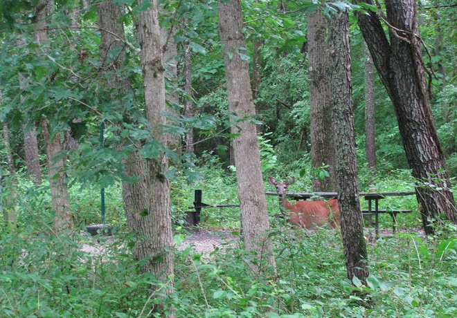
As is usual when we have stayed at Kickapoo in times past, an individual of the local deer population greeted us.
We enjoyed the company of this very interesting tree in our site, too. If we’d been staying longer, we probably would have used it to hang a hammock to lounge about some.

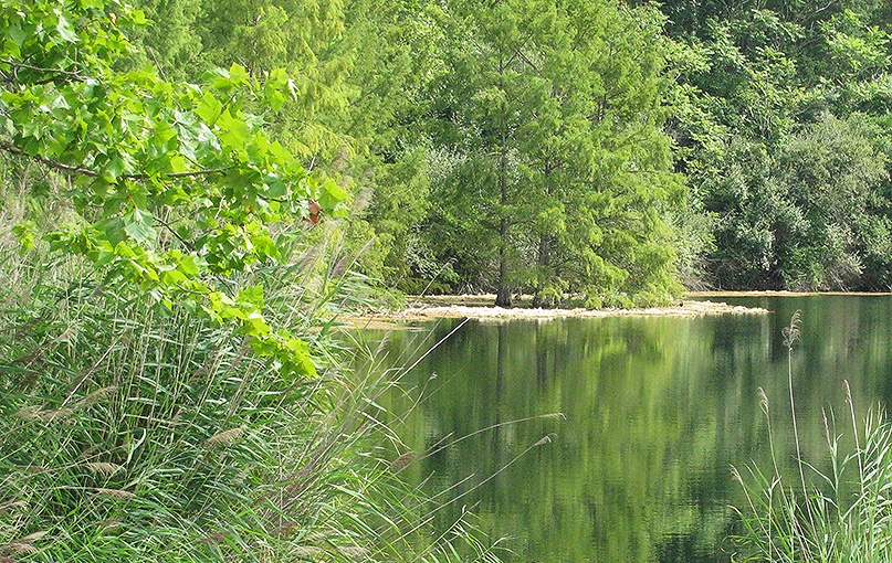
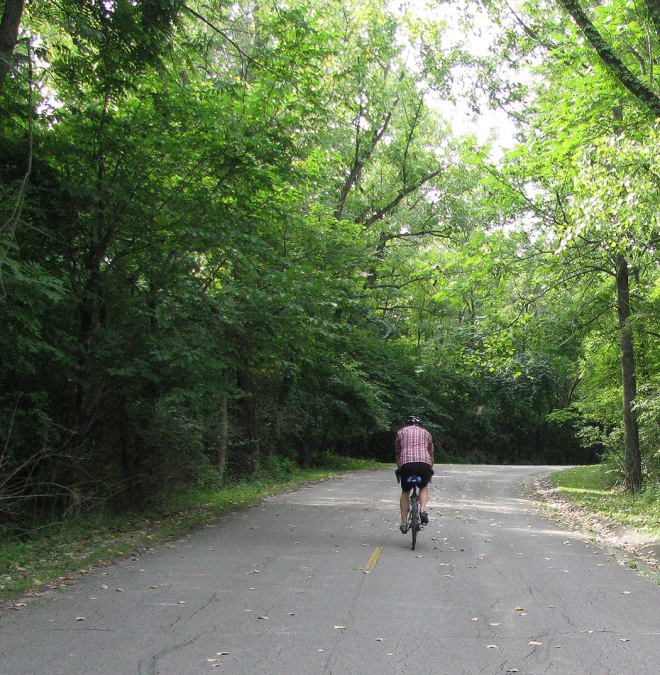
Instead of lounging, however, we set off on our bicycles to explore more of the park area than we’d ever had time to do in the past. This is a really huge recreational area, with hiking and mountain biking trails, and so many ponds and lakes I think one might get lost.
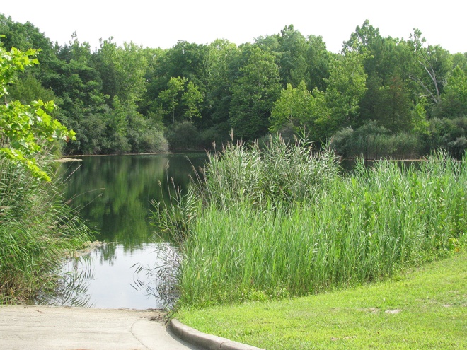
At the turn of the century, the area was a surface mining operation. We tried to ride to a mine “shaft” designated on the map, but it was gated—even though we rode around the gate, we stopped at a dilapidated old wooden bridge that had way too many saplings growing on it for comfortable crossing. The entire SRA is 2,842 acres, with 22 deep water ponds (221 acres of water) along the Vermillion River. The state purchased nearly 1,300 acres of the mining operation in 1939 from United Electric Coal Co. Most of the purchase price was raised from Danville, IL residents at the time. So if you’re a water or fishing enthusiast, it’s a great place to visit. Check it out here.


There is a ton of infrastructure around, but on a Monday, we encountered only enough vehicles to count on two hands; and we saw only a few individuals and families taking advantage of the vast amounts of fishing and paddling (most of the waterways are designated electric motors only) opportunities available. Maybe things are different on the weekends, but overall we found the place quiet and sedate. Surprisingly, there were very few printed materials available to folks who might want to know more about the trails, the history, or the amenities. Without actually riding on any of the “trails,” most of them appeared to be rugged, mountain-bike-only trails.
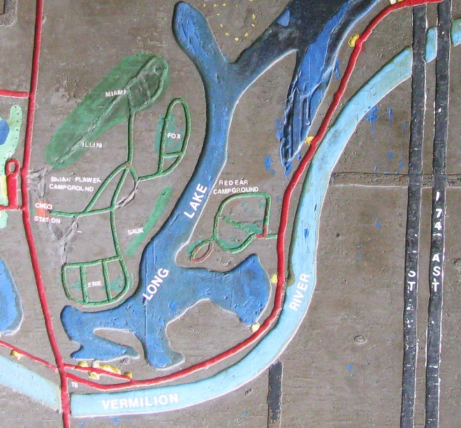
The park stretches on both sides of the I-74 corridor, with roadways going over and under the highway.

Here is a map of the whole shebang, that I’ve cut into two halves so it’s not so huge:


Our ride took us over all of the roadways designated in white, plus a few that don’t seem to be on any maps at all. The roadways and some of the put-in areas for boats and fishing were somewhat unkempt and in need of some TLC, but its an old park, after all. We took our time and tootled about for a couple of hours. It was pretty hot and muggy.
Bike Stats:
- Ride time = 1:25
- Stopped time = 1 hour
- Distance = 12.3 miles
After our exertions, we treated ourselves to another grilled salmon dinner—this time eating delicious wild sockeye, with grilled squash and Uncle Ben’s Wild Rice. Yum.

We headed to Ohio the next morning, to Paint Creek State Park (near Bainbridge, OH), where it began to rain and refused to stop the entire time we were there. We also moved from central time to eastern time, and started the adjustment to misplacing an hour somewhere along the way.
Our site (#125) was the same one we’ve stayed at before, because so many of the sites are elevated (nice and level) parking areas where both sides of the “lawn” areas fall off sharply from the site, making erecting an awning difficult if not impossible. While #125 is rather sandwiched among other sites, the one to our “face” was empty this time, and with the rain keeping us indoors anyway, it was not a problem.
The bath house is fine, but augmented with a couple of toilet-only structures, and there’s a laundry, but no dish washing station. And the sites are all either unserviced or electric-only.
Since it was raining steadily, and since we stayed indoors the whole time, the lack of tremendous amenities was not a problem (check the link above to our prior, 2017 stop here to see more of the lay of the land). We have, however, thoroughly enjoyed a long bit of in-campground cycling in the past.
The State Park is another boating haven, with the reservoir created when Paint Creek was impounded providing power boat and jet ski entertainment, as well as more sedate fishing, canoeing/kayaking, and swimming opportunities. There are also hiking trails and a few Mountain biking trails, plus a disc golf course (and an archery range), but few cycling options other than the campground roadways. The park office offers wifi, but otherwise, cell service (Verizon) is non-existent.
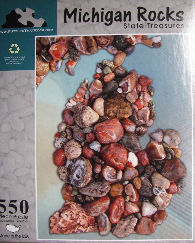
We started a jigsaw puzzle we’d purchased in Michigan at the Sleeping Bear Dunes gift shop, featuring pretty Michigan rocks in the shape of the state. It was fun but very challenging.
To the patter of rain on the roof, we got about a third of it put together on our nook table before calling it a day at 12:30A in the EST, where we felt it was still 11:30 CST.
The next day, we continued putting the puzzle together through breakfast and lunch, and finished around 2 in the afternoon. We didn’t want to get it partway done and have to undo all our work before our departure on Wednesday, August 8, so we kept at it. And it kept raining.
For our evening’s entertainment, we watched the third of the three movies we’d brought along: Three Billboards Outside of Ebbing, MO. We found it to be a tight, unsettling story very well told, with just enough ambiguity to provoke lots of thought. Troubling, overall—leaves you wondering what you might have done in a similar situation. Well worth the look-see.
Still damp, we left for Grindstone Federal Campground in the Mt. Rogers Recreation area, near Damascus, VA: our final stop along this odyssey, back to Virginia with friends and neighbors for the first time in nearly 6 weeks. What a fun adventure it’s been.
